Showing posts with label Hill Forts. Show all posts

08 August 2011

31-Jul-2011 : Kothaligada


We visited one interesting fort - Kothaligad. This fort is also known by the base village Peth. The unique features of this fort are: the beautiful carvings in the main cave of the fort; the stairs carved through a tunnel to reach the top of the fort; beautiful patches of jungle on the way. Let us relive these experiences in this writeup. Hope this will keep you interested and make a visit to the place.


Location and getting there:

The fort is near Karjat, in Thane district of Maharashtra. To visit this fort, one has to come to Karjat. This town is accessible from Mumbai by local trains. From Pune, one has to come by a bus. Having a private transport is advisable as it will only save time and avoid unnecessary wait.


From Karjat, Ambivali village is nearly 20 kilometers. It takes about half an hour from Karjat to reach Ambivali village. The road is good. From Ambivali, the unpaved road winds up to Peth village. From Pune, the overall journey takes about 3 hours.


History:
There is no significant history associated with this fort. However, this fort has been mentioned in the history. It can be concluded that the Marathas used this fort as ammunition storage.


During Sambhaji Maharaj's time, Manakoji Pandhare became traitor and got admitted one Abdul Kadar along with his troops. They slayed the men stationed at the fort. Abdul Kadar presented the golden key to Aurangzeb as a proof. To confirm this Aurangzeb sent one of the very trusted person to the fort. He awarded 10,000 rupees to Abdul Kadar and 2,500 rupees to the moles only after confirming that the fort was really taken in possession. The fort was renamed as Miftah ul Fatah (key to victory).


Later sometime, Naroji Tryambak tried to capture the fort. But he was killed. His body was mutilated by Iddatmam Khan.


There is no other mention of this fort in the history.


Trek
We started from Pune by a private bus at around 6:30 AM. The bus reached Karjat in about 3 hours along old Mumbai Pune highway via Khopoli. En route, we had our breakfast on Mumbai Goa highway. 


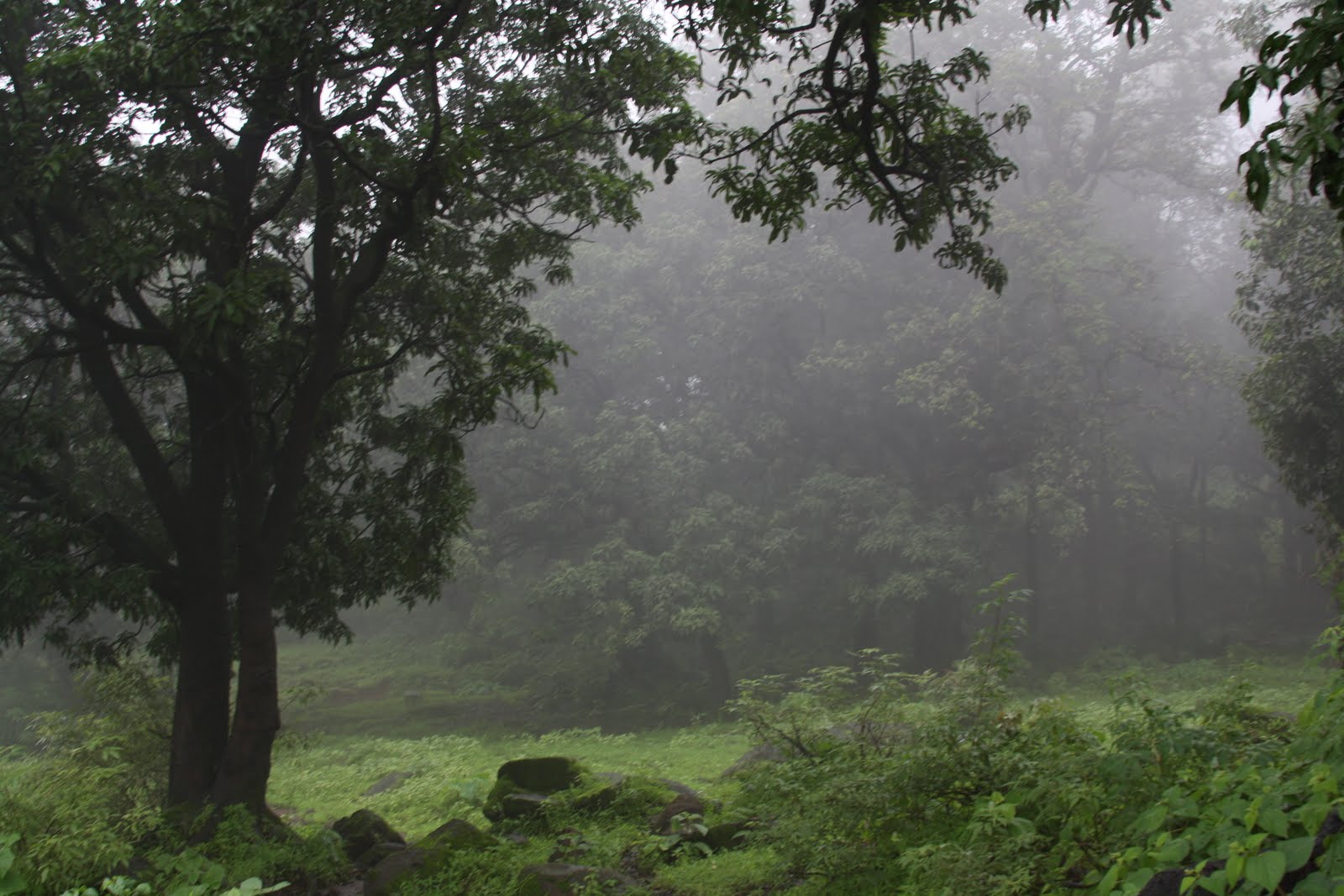
It was raining heavily in those days. Hence everywhere it was lush green and pleasant. There is a distinct joy in travelling during rainy season. The atmosphere is pleasant and refreshing. These kind of breaks are needed for us who stay in big cities and cut off from nature.

By 10 AM, we were in Ambavali village. From this village, we had to trek for nearly 4 hours to reach the fort. For some distance, the road is tarred. Soon after, the road converted into unpaved one. After passing through the gentle incline and fields on one side, the scene changes. Now the road became narrow, steep. The trees became taller. We were getting the feel of jungle. As the road was winding uphill, we could see tall, thick evergreen trees 
below. In the rainy season, these trees looked more beautiful. Sound of birds, insects, and flowing water made the jungle lively. Recent heavy rains had filled all ponds, the streams were flowing with some force and a lot of noise, and waterfalls were flowing with full force.


Along the way, we could see one spider catching its prey in its web. There was a hairy crawler moving on one of the leaf. Then a spider appeared to move in the air without any support! Of course, it had its strand of web attached. But it was not visible to us. Jim Corbett rightly said, jungles in India are lively.


After walking for nearly one and half hours, we reached a plateau. Now the jungle around suddenly disappeared. We could see Kothaligad immersed in clouds. The valley below was deep. We waited here for nearly half an hour to get the glimpse of Kothaligada. But to our dismay, the clouds increased. As it would take further one and half an hour to reach the fort, we decided to resume the journey.


Now we were walking along the plateau towards Peth village. The wind was blowing. And the clouds were following. The entire experience was like a dream. Suddenly, for a few moments, there came the high point of the trek. Due to heavy winds, the clouds cleared view of Kothalogada. We could see the entire fort from one side. From the other side, the clouds were trailing the fort for quite a distance. The fort was preventing the wind to move the clouds on the other side. Unfortunately I do not have that moment captured in the camera. No camera can capture such an intimate mesmerizing experience faithfully. 


In another half an hour we reached Peth village. The village is small. It is filthy. There is a hotel which can make arrangements for food. There is a small, but well kept temple of Hanuman. The children in the village offer to guide to the fort for some pocket money. However, the route is straight. 


After taking 10-15 minutes break break, we resumed journey. By now, it was more than 3 hours since we started. We were walking on a narrow path. The slope had become steeper. The trees were taller. It was drizzling in between. There were steps along the route. Soon we reached a rock patch. But for the rains, this rock patch is very easy. The rains made it more slippery. Slowly but carefully, we negotiated the rock patch.


The entrance of the fort is small. It is broken. Not much fortification has survived. We can easily guess that the fortification we see near entrance has been constructed relatively recently.


The main caves are just a few meters away from the entrance of the fort. Just before entering the cave, there is a shrine and a water tank. There are steps leading to the top of the fort. The shrine is in one of the smaller caves. It appears to be that of Lord Rama and Sita.


Now we enter into the main attraction of the fort. A large cave dedicated to Bhairoba. There is an idol in the main chamber of the cave. It was almost 2 PM by now. We had started our journey from Ambivali nearly 4 hours ago. 


The main chamber has three intricate pillars. One of them has been damaged extensively. Each of these pillars had extensive artwork. Due to neglect, the artwork is worn out by now. Even the window of the main chamber has beautiful artwork.


The main chamber of the cave has inner chamber. The entrance of the inner chamber has intricate artwork. Due to low light, the visibility was very less. By now, heavy rains started outside. After having our lunch in the cave, we started to explore the top.


Just outside the entrance of the cave, there are steps carved out of the rock. These steps lead to the top of the fort. The first few steps are broken. During rains, they can be slippery and hence become dangerous. We need to be careful. Soon enough we reach the top of the flight of the stairs. But not before we are gasping for breath.

For a small section, there is a deep exposure. Since it was raining heavily, we could not see the depth. The ascent was steep and slippery. Soon we reached the second flight of the stairs. These stairs have one entrance at the top. The upper most part of the fort lies beyond this entrance.

The uppermost part of the fort is rather small. There is no construction. It would give beautiful view of Bheemashankar, Siddhagad on the North; Nakhinda peak on the East; Malangagad, Chanderi, Prabalgad, Manikgad, Matheran on South West and South. However, since it was raining very heavily, nothing was visible.

After seeing the top, we descended carefully to the cave first. Just outside the cave, there is a canon lying in the state of neglect.


We carefully started our descent to Peth village. As it was raining heavily, the descent was careful. From Peth village the march on the plateau was very swift. We looked back to get a glimpse of the fort. However, it was immersed in the clouds.


While descending through the jungle, we collected water dripping through rocks. That would have been filtered and purified far better than any of the bottled water. As it was raining heavily, there was no sign of any bird, butterflies, or anything moving. The same winding path took us back to Ambivali. After changing the cloths, we started back to Pune. We were in Pune by 9:00 PM.


What a thrilling experience! Jungle, rain, beautiful flowers, beautiful carvings in the cave. 


I wish, 
a) The beautiful carvings are restored and protected from crumbling. 
b) The inner cave is kept clean and free of bats. 
c) The stairs are repaired so that they remain usable. If they break any further, then it will be difficult to climb to the top of the fort.

References:
Palande
Ghanekar


02 August 2011

24-Jul-2011 : Irshaalgada


From Trek - Irshaalagada Jul 11


Irshaalagada is a small fort near Prabalagada. Today, let us look at our interesting visit to the fort during monsoon (rainy season in India). We will see the scenic landscape made more beautiful by the greenery around. We will also see the beautiful village Irshaalawaadi on the maachi of the fort. We will also see the difficult patches on the last phase of the ascent. This fort is worth visiting for the beautiful landscape around and for rock climbing. Hope you will find this narration interesting and useful.


Location and getting there:


Irshaalagada is easily accessible from Mumbai, Thane, Pune.


From Pune, take expressway upto Khopoli. Exit expressway in Khopoli and come on NH4 (Old Mumbai Pune highway). Proceed towards Mumbai. Soon after, we reach Chowk.


From Mumbai or Thane, reach Panvel. Proceed to Shendung and then Chowk along Old Mumbai Pune highway.


Chowk is a station on Konkan Railway. Here we exit the highway and proceed to Karja. This village is nearly 4-5 kilometers from the highway. It is the base village for Irshaalagada.


This journey is possible by public transport. However, to manage time better, it is advisable to arrange for own transport.


History:
There is no recorded history about this fort.


Trek:
We started from Pune by a private bus at around 7:00 AM. Unfortunately, the bus developed some technical problem. The driver was apprehensive about driving in that condition. Finally, by 8:00 AM, we were coasting on Old Mumbai Pune highway. It was not raining at the moment. However, everything was wet. The Earth wore green. It was a pleasant sight. By 9:30 AM, we reached Khopoli. The bus stopped for breakfast. The driver took time out for repairs. (Pun intended.) Finally we were back again on the Old Mumbai Pune highway. We soon reached a place called Chowk. Here we exited the highway towards Karja village. At last, we were in Karja by 11:45 AM.


The present village is situated on the bank of Morbe dam. It must have been resettled by the dam, as the houses were relatively better arranged. The bus was parked outside the village along the bank of the dam. Our further journey was to be on the feet.


Irshaalagada was partially immersed in the clouds. For a few moments, we could see the saddle shape of Irshaalagada. Suddenly I was remineded of Madhu-Makarandagada.


We started our trek Just outside the village, the slope is gradual. Soon after we reach to mini forest primarily consisting of Teak trees. Now we encountered first steep incline. When we looked back towards the dam, it was an enchanting sight. The black clouds had gathered. They could empty anytime. It was just like a huge umbrella overhead. Now we were walking on a narrow ridge. From both sides, we could see the tree cover. It looked like evergreen in the rainy season at least! Then came another steep incline. These sections do not have too many rocks. Hence it is difficult to get a grip. In wet conditions, due to mud; and otherwise due to lose soil.


By 12:00 noon, we were walking on the plain ground. There were paddy fields. Soon as reached Irshaalawaadi village. It is a small village comprising of 10-15 huts. Big trees covered entire Irshaalawaadi village. This village was very beautiful. I am thrilled to imagined how it would be in winter. One of the most beautiful places to stay! We halted in the village. The village is not commercial at all. We cannot expect to get any provisions here.


After about 10 minutes of rest, we took left turn and continued along a narrow pathway. There are chance to get lost here. During monsoon, as there is a green cover everywhere, a lot of traces are covered. Hence we need to be careful. There were trees along the route. Now we climbed a steep slope. Due to mud, this was negotiated very carefully. Immediately, thereafter, there are lose rocks. Not sure if there was any construction during earlier times.After walking a little further, we come to a plateau. The wind was blowing. It was difficult to balance. The grass was inclined due to constant wind. As we walked a little further, we come to the opposite side of Irshaalagada from Irshaalawaadi. On one side, the big wall of Irshaalagada and on the other side, depth of the maachi. Soon, we reached the rock patch.


The rock patch is of medium difficulty. However, it was wet. Hence one needs to be very careful. Rocks do not have grip when wet. We saw that another group was descending down. Hence we had to wait there. From here, the path to Nedhe includes a couple of patches and some scree. The leaders setup the rope. One by one, we started to climb the first patch. That was relatively easy. Next we come to the second patch. There is a wooden stair. However we are supposed to climb it without holding it. This patch was negotiated with the help of our leaders. Next came some section with scree. As it was wet and there were absolutely no holds, it was little tricky. After negotiating with this section, we came right in the Nedhe. It was 1:30 PM.


Any further ascent needed technical equipment. We were to have our lunch here and descend back. It took another half an hour for the entire group to come up to Nedhe. The place here can accommodate only 30-40 persons at a time. In between, the clouds were kind enough to give a glimpse of the top. There are a couple of plaques in the memory of climbers who perished here. This place appears to be regularly visited by climbers.


Prabalagada and Matheraan can be seen in the North. Karnaala can be seen on the West. Maanikagada can be seen on the South. However, none of this was visible at the time.


After having lunch, we decided to start the descent. It was 3:00 PM now. The descent had to be more careful. Soon, it started raining heavily. Slowly, but surely, all of us negotiated the rock patch. Of course with the help of our capable leaders. On the way, we collected "mineral" water flowing from virgin streams. This should the real mineral water. All minerals dissolved in it. Purified by the rocks. Soon, we reached Irshaalawaadi, and continued our march towards Karja. It was still raining heavily. Some of us slipped on the grass! Nothing to laugh at. But slope, grass, and speed all combined. Now, the rain receded. We took some photographs. By 5:00 PM, we were back in Karja. But it was almost dark by then. There was no rain in Karja at that time. But up there, it must be raining for sure.


By 5:30 PM, we left Karja. Were back in Pune by 8:30 PM.


Another memorable monsoon sojourn! That is all I can describe this trek. The fort is technically not a fort. It must have hosted some soldiers. There is no trace of any construction. There is no place for any construction. Getting on the top is so difficult, even in the earlier times that only a handful of persons would be stationed here. It is said that there are water tanks on the top.


While descending, I saw this beautiful flower of Turmeric (Curcuma longa). It is only seen during monsoons, in wet conditions. It saps soon after it is plucked. Its complexion can vary slightly. Sometimes, it is darker. Other times, it is almost white. We use turmeric so much. But I have seen the plant and flower in the wild until recently. And It is one of the most beloved flower for me.


11 July 2011

10-Jul-2011 : Rohidaa Fort and Bhor Palace

Welcome. In this post, we will see our interesting visit to Rohidaa Fort and Bhor Palace. This fort is also known as Vichitragada. It is known for winds during monsoon. Let us try to recreate the trek.


Location and getting there:


From Swargate, take any bus to Bhor. It is about one hour journey. From Bhor, take any of the shared vehicles to Baajarawaadi village. This distance is about 15 kilometers. Make arrangements with the same person for return journey if there are more persons in the group. They take you for a "ride" for sure.

To manage time better, it is advisable to take own vehicle. The road upto Baajarawaadi is paved. Medium sized vehicles can ply.

History:
There is no recorded history of the fort.

Trek:
We started at 6:30 from Swargate. The bus dropped us on Bhor station in about an hour. For breakfast, we were searching for a hotel. At last, we could find one hotel open. Most of the marketplace was closed. As we had our breakfast, the leaders arranged for transport to Baajaarawaadi. The entire group was accommodated in two vehicles. In another hour, we were in Baajaarawaadi village. We could see Rohidaa fort in front of us. After introductions, the trek started. It was about 9:15 AM. The route upto the fort is over a ridge. The incline becomes steep in 2-3 places. There are poles along the route. So there was no question of missing the route.

As we gained some height, the scene was beautiful. It was lush green everywhere. Since it was not raining at that moment, the visibility was better. However some of us had come to the trek to get drenched in the rains. Slowly but surely, most of the group was in the first entrance of the fort in about hour's time. This entrance is small. There was a provision to station some soldiers here. The wooden door that we see is recently made.  After coming inside this entrance, there are some stairs which lead to the second entrance. Here we can see one broken/worn out idol of an elephant. There are Sharabhas on this entrance. Some more soldiers could be posted here. We then come to the third entrance. This is peculiar. There is no construction surviving around the structure. So the entrance appears stand alone. Sun and Moon are carved on either side of the entrance. Two elephant-heads adorn the entrance. There are two inscriptions - one in Devanagari and the other in Urdu or Farasi. Once we are inside this entrance, there are remains of an erstwhile office - Sadar. The only structure on the fort is that of Rohideshwara temple. It is renovated recently. We were on the fort by 10:30 AM! It took us around 1 hour to climb up.


We took a stroll on the fort. On the North, there is Waaghjaai bastion. There is one derelict temple on this ridge. It is dedicated to Ashtabhuja and Chaturbhuja goddesses. The bastion is in a very good condition. On the East side, Fatteh bastion and Sadar bastion. Sadar bastion is where we enter from. This is the bastion we see in the middle when we ascend the fort. Patane and Damgude bastions are on the West. Shirawale bastion is on the South. Shiravale and Waaghjaai bastions were the main bastions. They are in good condition even today. There is a toilet on Shiravale bastion. The fortification is in good condition between Fatteh and Waaghjaai bastions. There is one secret entrance between these bastions. Since the main entrance is also from the same direction, it is difficult to understand the reason.


In the North side, there are several connected water cisterns. One of them is underground. There is one human statue in the sitting position. We could not notice any of this near the tanks. There is one lime grinder on the fort. I missed this too.

Rohideshwara temple is renovated recently. Three idols comprise of Ganapati on the left, Rohideshwara (Bhairav) in the center, and Bhairavi (?) on the right. There is one water tank in front of the temple. There are several memorials for the deceased in front of the temple.


There are several forts visible from the top. Purandar, Vajragada can be seen on the East; Sinhagada is on the North; Rajagada, and Toranaa can be seen on the North West; Kenjalagada and Kamalagada are on the West; Raireshwara is on the South.

There were several groups on the top of the fort. Some were with small children.

By 1 PM, we started our descent. The rain at last did not disappoint. It started raining for about half an hour. Within 45 minutes we were back in Baajaarawaadi village. Now we had to wait for nearly one hour to get any vehicle back to Bhor. Meanwhile, we explored the village and its surroundings. There is no hotel in the village. So no provision for snacks or lunch. At last, we got some conveyance back to Bhor.


Bhor Palace
Since we had ample time in hand, we thought of exploring the palace. It was very easy to locate it. 5 minutes walk from the bus stand. The palace is in very good condition. Except for the first courtyard, everything was closed as it was Sunday.

Bhor was one of the Jahagirs attached to Satara state. It was founded by Shankaraji Narayan - one of the eight hereditary ministers appointed by Rajaram Maharaj in 1697. It was acceded to the Dominion of India on 8-Mar-1948.  The Pantasachivs - as the rulers were known sold off all the belongings in the palace. But they preserved the palace very well. Later it was given to Municipal Council on rent. Several public functions take place in the palace. Several films are shot here. It is remarkably preserved for us to see how it would have been. It is well kept by the caretakers.

We somehow got admission in the palace after pleading with the caretakers. After hearing our story, he opened the palace.

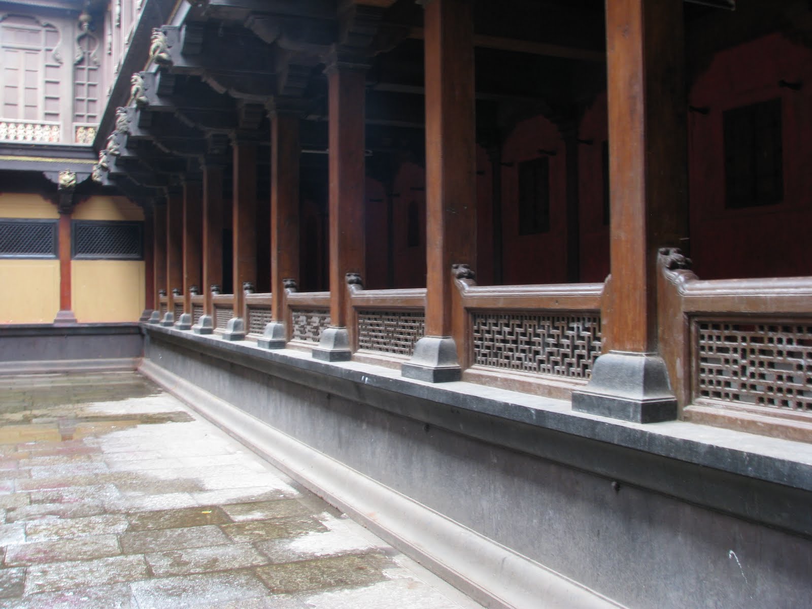
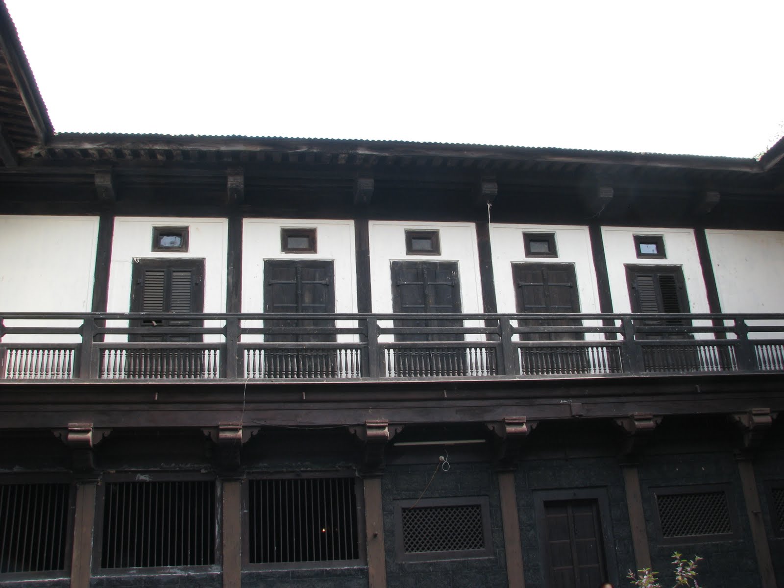
The main entrance is imposing. It consists of two layers. It does not open in the straight line. So elephants cannot enter through the door. We enter the first courtyard. Here is imposing entrance to the inner courtyard and the throne. There are steps leading to the second floor on either side of the entrance. The door is ornamental. The second courtyard is basically the court of the rulers. This is amazing. I had never seen anything like this before. On one side, there is balcony that opens int he courtyard. It has no walls. Each section has provision to keep some belongings. Probably, it was meant for some important persons coming from distant places. The throne occupies one side. On the other side, there is one temple of family deity. There are some long chambers. After crossing these, we enter the third courtyard. In the center of this courtyard, there is basil. This appears to be private area. Beyond this courtyard, there is fourth courtyard. But this section was locked. In Marathi, we cal it Chausaupi wada - meaning a house consisting of four courtyards. This indeed was! For that matter, a huge one. This was the high point of the trek. The entire structure is so well preserved, that several movies, serials are shot here.


After we were content, we left the place for Pune. We were back in Pune by 6:30 PM.

I wish more and more such structures are preserved. And their preservation is made viable. Our future generations can experience what it was in the past. Otherwise, their imaginations would be limited.